Sierra snowpack doubles after January storms blanket California
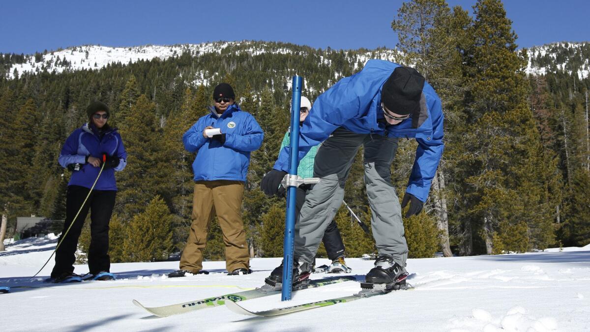
A series of January storms that brought record rains to the state and massive amounts of snow to the mountains helped double the snowpack in the Sierra Nevada, experts with the state Department of Water Resources said Thursday.
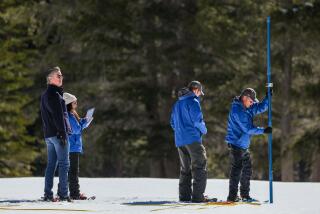
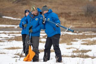
Surveyors recorded 50 inches of snow at the department’s Phillips station, where a layer of plush, thick powder covered the ground. The measurement is equal to 18 inches of water and brings the snowpack to 98% of average to date and 71% of average based on the April 1, 2018, measurement, according to John King, a water resources engineer.
Overall, the state’s snowpack is at 100% of average, based on the department’s statewide snow-monitoring network, he said.
Earlier this month, surveyors tracked a less-ideal result, with 25.5 inches of snow, or 80% of average for that date. But that was much better than the year before, when surveyors found nothing but small patches of snow on a dry bed of grassy land.
Now, the snowpack is in even better condition.
“It’s very encouraging, and we still have two more months to accumulate” before the April 1 measurement, when snowpack is typically the highest, King said.
In addition to the improved snowpack, multiple storms over the past month added 580 billion gallons of water to the state’s reservoirs.
Chris Orrock, a Department of Water Resources spokesman, said the new measurements are a stark contrast to last year, when the snow-water content was just 2.56 inches and 30% of average.
And more snow is on the horizon.
“Even though we’re coming out of a warm dry spell in the last week, the high-pressure zone has gone away and we’re bringing in some good weather to increase our snowpack,” he said.
This weekend is bringing a trio of storms to the state, including some that will pass through the Sierra Nevada. The National Weather Service issued a winter storm watch for snow and strong winds between Friday afternoon and Monday evening in the Sierra Nevada from Yosemite to Kings Canyon and the Tulare County Mountains.
Heavy snow is expected at elevations of 5,000 feet starting Friday, with a short break Sunday. By the end of the weekend, the weather service predicted 5 feet of snow will have dropped.
The same is true for the northern Sierra, and forecasters said heavy snow could reach lower elevations.
California’s climate has bounced up and down dramatically in recent years — wildly swinging from drought to deluge — so seeing an average year is a positive, experts said.
“We go from a record year in [2016 and 2017] that followed a multiyear drought … to this year,” Orrock said. “To be at average is great for people that look at the snowpack … to be able to look down the future and see what we’re able to supply.”
alejandra.reyesvelarde@latimes.com
Twitter: @r_valejandra
More to Read
Start your day right
Sign up for Essential California for news, features and recommendations from the L.A. Times and beyond in your inbox six days a week.
You may occasionally receive promotional content from the Los Angeles Times.
